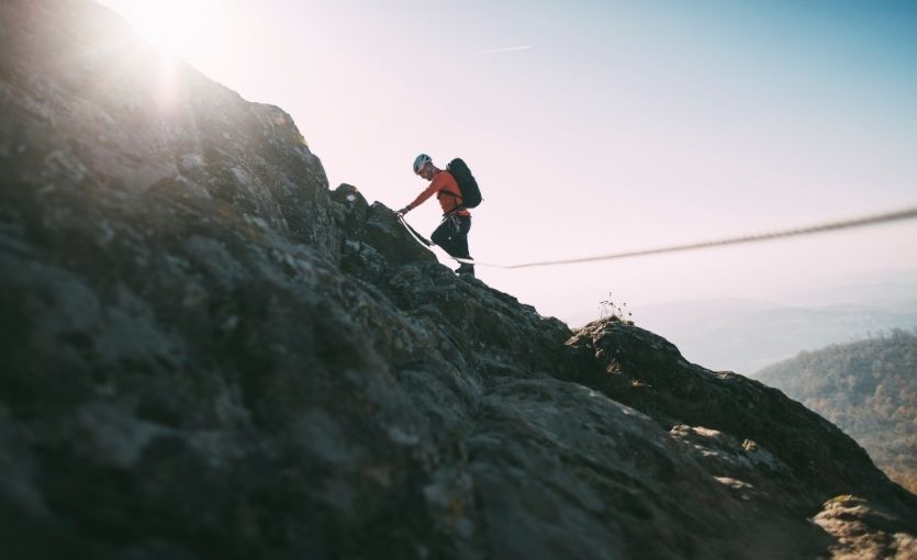
Türkiye is one of the most underrated climbing destinations in the world. It has everything: a limestone sport climbing area near Antalya that ranks among the top ten in Europe, a 5,137-meter glaciated volcano in the east that pulls alpinists from across the globe, an alpine massif in the Taurus range with multi-pitch routes up to 650 meters, dramatic canyon crags accessible from Istanbul in a day, and an entirely separate mountain range on the Black Sea coast with glacial lakes, remote ridgelines and the kind of terrain that rewards those who find it. Whether you want to clip bolts on overhanging tufas with the Mediterranean visible below, or spend four days gaining a summit visible from three countries, Türkiye has the route.
Clip, Send, Repeat: Geyikbayırı and the Sport Climbing Coast
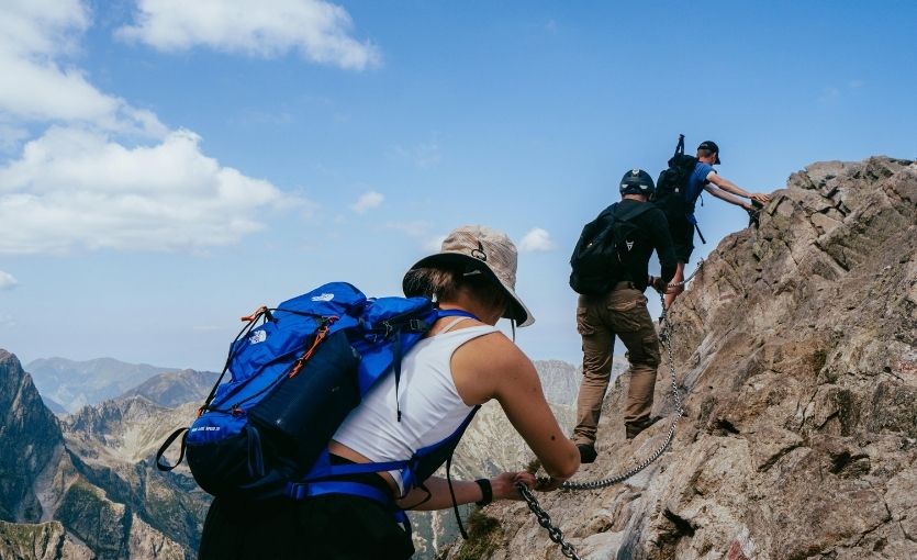
Geyikbayırı is, without qualification, the best sport climbing area in Türkiye and one of the finest in Europe. Located 25 kilometers northwest of Antalya in the foothills of the Taurus Mountains, the area offers more than 1,300 single-pitch sport routes on high-quality limestone across a range of sectors, and the diversity of climbing styles is extraordinary — technical face climbing on pocketed limestone, three-dimensional routes navigating stalactites and bomber tufas, steep cave climbing on 40-meter overhangs, and everything in between. The grades range from beginner-friendly 4s and 5s up to elite-level 9a, which means the crag works for a first-day sport climber and a professional athlete simultaneously. The best season is October through April; the summer altitude sectors at Feslekan Yayla (2,000m) keep things cool in the heat. Fly to Antalya — direct from 15 German airports and all five UK airports. The Antalya summer guide covers what to combine with a climbing trip.
GEYIKBAYIRI
Best season: Oct–Apr · Region: 25km from Antalya
FACTS ALONG THE ROUTE
- 1,300+ routes: From beginner slabs to elite 9a overhangs
- Tufas & stalactites: Three-dimensional cave climbing on 40m overhangs
- Year-round climbing: 6°C January minimum — warm even in deep winter
- All levels welcome: Beginner 4s and world-class 9as on the same cliff
- Feslekan Yayla: Summer bouldering at 2,000m when lowlands are too hot
- Full infrastructure: Campsites, bungalows, cafes and gear hire on site
Going Vertical: Aladağlar and the Taurus Alpine Experience
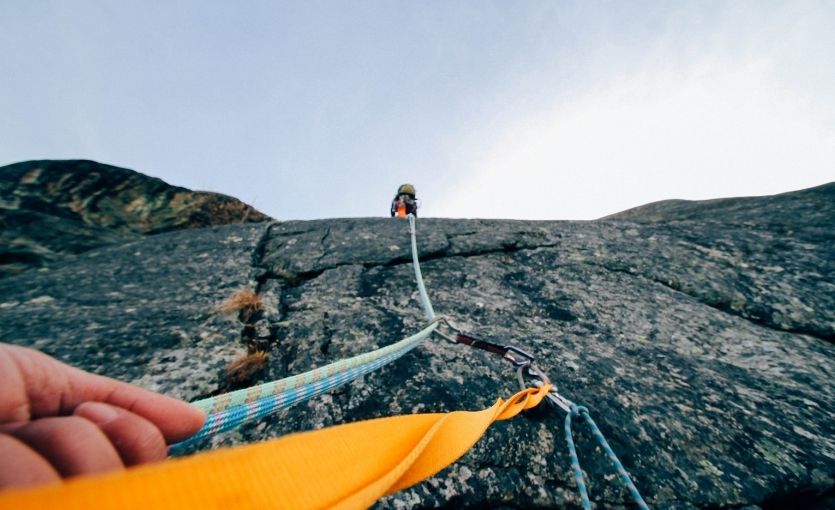
Aladağlar National Park is where Türkiye’s rock climbing goes fully alpine. The massif sits at the junction of Niğde, Kayseri and Adana provinces in the Taurus range, and its highest point — Demirkazık, at 3,771 meters — is the highest peak in the Taurus Mountains and one of the most technically interesting mountains in the country. The park is home to hundreds of bolted and traditional multi-pitch routes ranging from 200 to 650 meters in length, spread across multiple valleys and cliff systems. The Cimbar Valley has easier single-pitch routes for intermediate climbers; the Narpuz Canyon offers steeper, more committing lines. Türkiye’s Top 7 Treks covers the hiking in the same area. Fly to Kayseri — direct Pegasus connection, 90km from the park by hire car.
ALADAĞLAR
Best season: Jun–Sep · Region: Niğde / Kayseri
FACTS ALONG THE ROUTE
- Demirkazık: 3,771m: Highest peak in the Taurus — serious alpine objective
- Routes up to 650m: Hundreds of bolted and trad lines through the massif
- Cimbar Valley: Best base for moderate routes and sport intro climbing
- Narpuz Canyon: Steeper, more committing faces on excellent grey limestone
- Wild camping: Camp in the national park — no permit needed here
- Fly Kayseri: Pegasus direct — 90km to the park gate by hire car
The Mountain of Pain, the View of a Lifetime: Ağrı Dağı (Ararat)
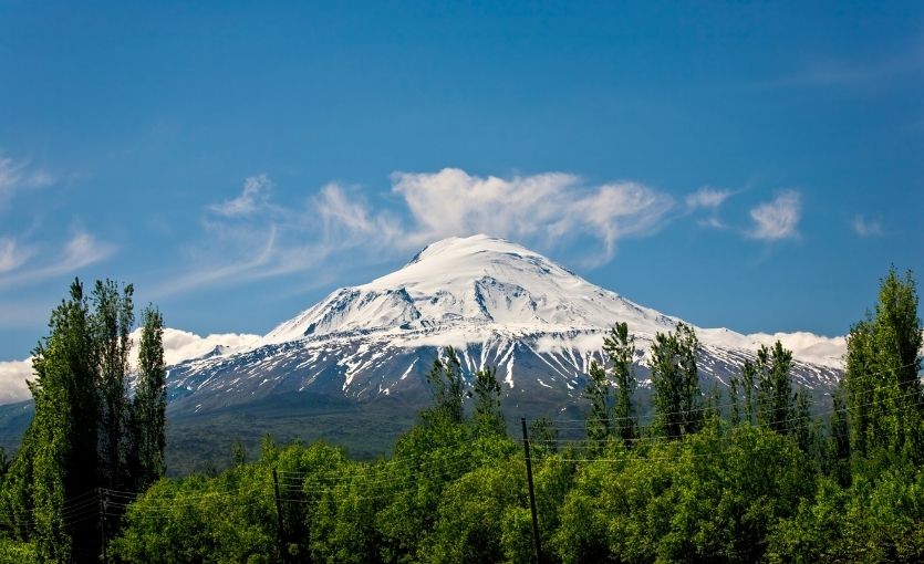
Mount Ararat is the highest peak in Türkiye and one of the most psychologically significant mountains in the world. Known in Turkish as Ağrı Dağı — the Mountain of Pain — the glaciated volcanic cone looms over the plains of eastern Anatolia near Doğubayazıt, visible from Armenia, Iran and Azerbaijan on clear days, and identified in ancient tradition as the resting place of Noah’s Ark. It is not a technical climb on its standard southern route, but at 5,137 meters, with altitude sickness a genuine risk, unpredictable weather, scree fields that drain the legs for hours, and glacial sections requiring crampons and ice axes near the summit, it demands respect, preparation and experience. A government permit is mandatory for all climbers and a licensed local guide is effectively required to obtain one. Book both well in advance. Fly to Ağrı — direct Pegasus connection — and drive to Doğubayazıt (95km). Alternatively fly to Van (210km west).
AĞRI DAĞI (ARARAT)
Best season: Jun–Sep · Region: Doğubayazıt / East Anatolia
FACTS ALONG THE ROUTE
- Visible from 3 countries: Armenia, Iran and Azerbaijan on a clear summit day
- Noah’s Ark tradition: Biblical tradition places the Ark’s resting place here
- Scree & glacier: Long scree slogs to high camp, then ice axe to the top
- Altitude is the challenge: Headaches common above 4,000m — acclimatize at Camp 1
- Permit mandatory: Government permit + licensed guide required — book ahead
- Fly Ağrı direct: Pegasus connection — drive 95km to Doğubayazıt base
Where the Black Sea Meets the Sky: The Kaçkar Mountains
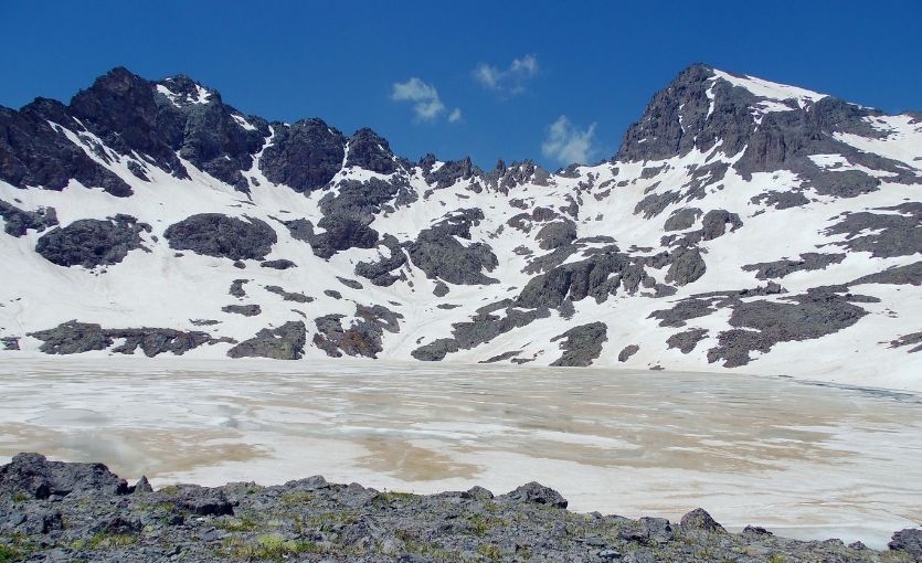
The Kaçkar Mountains are the most beautiful and least visited significant mountain range in Türkiye. Rising steeply from the Black Sea coast in the Rize and Artvin provinces, the range has a character entirely different from the dry limestone of the Taurus or the volcanic plains of eastern Anatolia: the northern slopes receive heavy Black Sea rainfall and are covered in dense rhododendron forest and alpine meadows; the high terrain between them — glacial lakes, rocky ridgelines, snow patches that persist through summer — has the quality of the Alps in miniature. The traverses of the range, crossing from the Black Sea side to the southern valleys over multiple high passes, are among the finest multi-day treks in the country. Offline Routes: Digital Detox Türkiye covers the Kaçkar in the context of Türkiye’s most peaceful destinations. Fly to Rize-Artvin — direct Pegasus connection on the Black Sea coast.
KAÇKAR MOUNTAINS
Best season: Jul–Sep · Region: Rize / Artvin
FACTS ALONG THE ROUTE
- Glacial lake terrain: Rhododendron forests, alpine meadows and snow all summer
- The great traverse: Cross the range from Black Sea to southern valleys in 5 days
- Summit in 5–6 hours: No technical gear in season — snow travel in early July
- Yayla hospitality: Mountain village guesthouses along all main approach routes
- Black Sea character: Lush north slopes unlike anywhere else in Türkiye
- Fly Rize-Artvin: Pegasus direct — 65km to Ayder trailhead by hire car
Crater to Carve: Erciyes, Cappadocia’s Summit and Ski Mountain
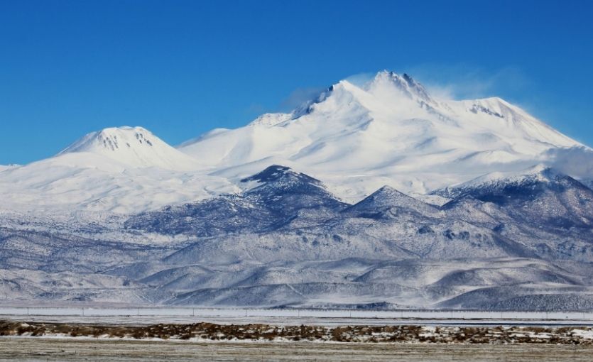
Mount Erciyes, the dormant volcano that dominates the skyline above Kayseri in central Anatolia, is the natural companion to a visit to Cappadocia — the two destinations are 60 kilometers apart and together cover everything from underground cities and fairy chimneys to high-altitude mountaineering. In summer, Erciyes offers a strenuous but non-technical ascent to 3,864 meters with crampons and ice axes required near the summit. In winter, Erciyes transforms into Türkiye’s most extensive ski resort, with 35 kilometers of pisted runs and modern lift infrastructure. Above the Fairy Chimneys: The Complete Cappadocia Balloon Guide and The Best Cappadocia Holiday Guide cover the wider destination. Fly to Kayseri — direct Pegasus connection, 25km from the mountain base.
ERCIYES
Best season: Jun–Aug · Dec–Mar · Region: Kayseri
FACTS ALONG THE ROUTE
- Dormant volcano: Broad volcanic slopes — totally different from Taurus limestone
- Crampons near summit: Snow and ice persist year-round above 3,500m
- 35km of pisted ski runs: Türkiye’s largest ski resort — Alpine-standard lifts
- Cappadocia 60km away: Combine summit dawn with fairy chimneys and cave hotels
- Crater lake views: Deep blue lake visible on the descent from the plateau
- Fly Kayseri direct: Pegasus direct — 25km from airport to mountain base
The Volcano the Lake Forgot: Süphan Dağı Above Van
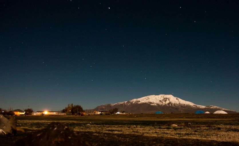
Süphan Dağı, rising 4,058 meters from the northwestern shore of Lake Van, is the fourth-highest peak in Türkiye and one of the most dramatically situated. The approach to the mountain takes you through Kurdish villages and across terrain that has a wildness and remoteness that the more touristed mountains of the west do not share. The summit — a broad volcanic plateau with a crater — provides views over Lake Van, the largest lake in Türkiye, and the surrounding plains of eastern Anatolia that are among the most expansive available from any summit in the country. The ascent is non-technical in good conditions but the altitude and remoteness make a guide strongly advisable. Fly to Van — direct Pegasus connection, 80km northwest to the mountain.
SÜPHAN DAĞI
Best season: Jun–Sep · Region: Van / Bitlis
FACTS ALONG THE ROUTE
- 4th highest in Türkiye: After Ararat, Uludoruk and Cilo-Sat in the remote southeast
- Lake Van backdrop: Most dramatically situated summit in all of eastern Türkiye
- 300km summit panorama: Vast volcanic plateau — Iran, Armenia and Iraq on clear days
- Wild eastern Türkiye: Remoteness and wildness the western peaks cannot match
- Guide strongly advised: Altitude + true remoteness make solo ascent genuinely risky
- Fly Van direct: Pegasus direct — 80km northwest by hire car to the mountain
Hanging Around: More Sport Climbing at Olympos, Ballıkayalar and Kaynaklar
Olympos (Antalya) — ruins at the crag, Mediterranean at the base
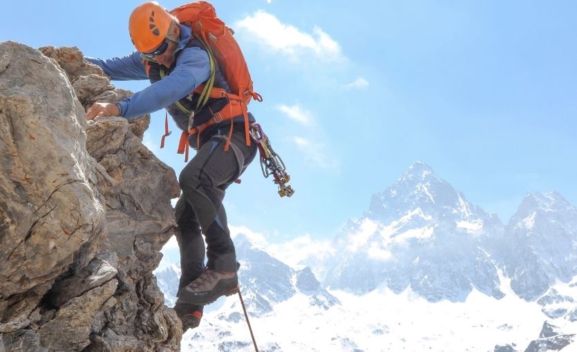
The climbing area around the ancient city of Olympos offers sport climbing on high-quality limestone with the ruins of a Lycian city visible from the crag and the Mediterranean glittering below. The Hörgüç area has single-pitch routes across grades. Fly to Antalya and drive 85km southwest on the coast road.
Ballıkayalar Canyon (Kocaeli) — Istanbul’s closest crag
A dramatic limestone canyon with sport routes across grades, accessible in 90 minutes from Istanbul. The rock turns orange in the afternoon light and the routes follow diagonal crack systems up faces that look steeper than they are from below. Best in spring and autumn.
Kaynaklar (İzmir) — western Türkiye’s premier sport crag
Thirty minutes from İzmir, Kaynaklar offers over 250 bolted routes on solid limestone with a year-round season. The most developed sport climbing area in western Türkiye. Fly to İzmir — direct Pegasus connection from across Europe.
Gear, Permits and When to Go
Permits
Mount Ararat requires a government permit obtained through an authorized guide agency — it cannot be climbed independently. Aladağlar, Kaçkar, Erciyes and Süphan do not require permits but all benefit from licensed local guides for alpine routes. Geyikbayırı is freely accessible.
Gear by discipline
Sport climbing: Rock shoes, harness, helmet, 60–70m rope, 12–15 quickdraws. Most Geyikbayırı camps offer hire.
Alpine / multi-pitch: Full rack, half ropes, helmet, crampons and ice axe for early season, mountaineering boots.
High altitude: Crampons, ice axe, mountaineering boots rated to -20°C, sleeping bag rated to -15°C.
Seasonal quick reference
Oct–Apr: Geyikbayırı. Warm and dry — perfect sport climbing.
Jun–Sep: Ararat, Kaçkar, Aladağlar, Süphan, Erciyes. All high-altitude objectives.
Dec–Mar: Erciyes skiing. Geyikbayırı continues through winter.
Use how to find cheap flights to lock in fares early. Check the baggage allowance page — a rope, rack and mountaineering boots add significant weight. Consider the upgrade package for flexibility on a weather-dependent trip. Pre-order your in-flight meal via Pegasus Café up to 24 hours before departure. The routes will be there when you land. They have been for millions of years.